Request for advice - mathematical operations
I want to know if there are any plugins, widgets or macros that allow me to make this calculation.
I have the tiddler which has the ‘point’ field which contains latitude and longitude.
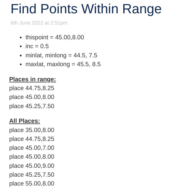
I want to get 4 points by increasing and decreasing latitude and longitude to create a square around the point.
I define the increment in value in an ‘inc’ variable.
if inc is “0.5” and point is “45.00,8.00”
I want:
p1 = 44.50,7.50
p2 = 44.50.8.50
p3 = 45.50.7.50
p4 = 45.50.8.50
and in a second step I will filter for all my tiddlers that have pont inside this square.
Now I’m stuck in the first part, getting the four points.
With this I split latidudine longitudine, but if I use the Mathematics Operators sum or subtract I sum / subtract latidudine and longitudine. Not what I want
<$ vars inc = “0.5”>
<$ list filter = “[all [current] get [point] split [,] trim [] fixed [4]] sum []” variable = center>
center + inc
center - inc
</ $ list>
</ $ vars>
I’ve found the “http://mathcell.tiddlyspot.com/” and the $ calc widget, but are there better ways to do this?
Thanks